The Republic of Djibouti serves as a critical logistics hub for the Horn of Africa. As part of Djibouti Vision 2035, the national development strategy aims to position the country as a regional commercial and logistics center.
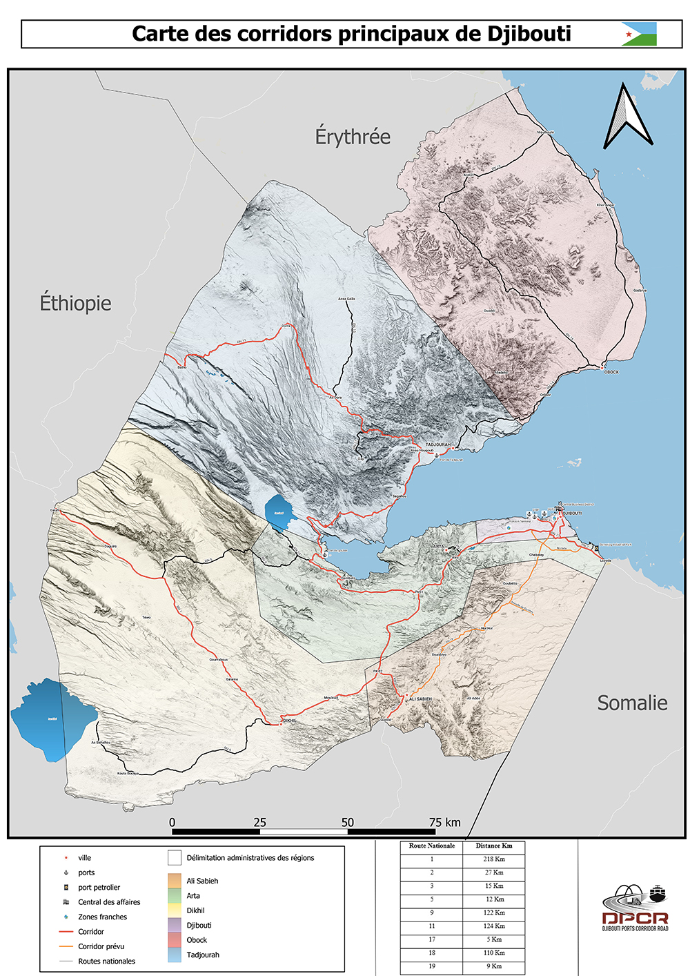
Djibouti functions as Ethiopia’s primary maritime access point. The road corridor network managed by DPCR spans 642 kilometers, carrying the majority of freight traffic between Ethiopian markets and Djiboutian port facilities.
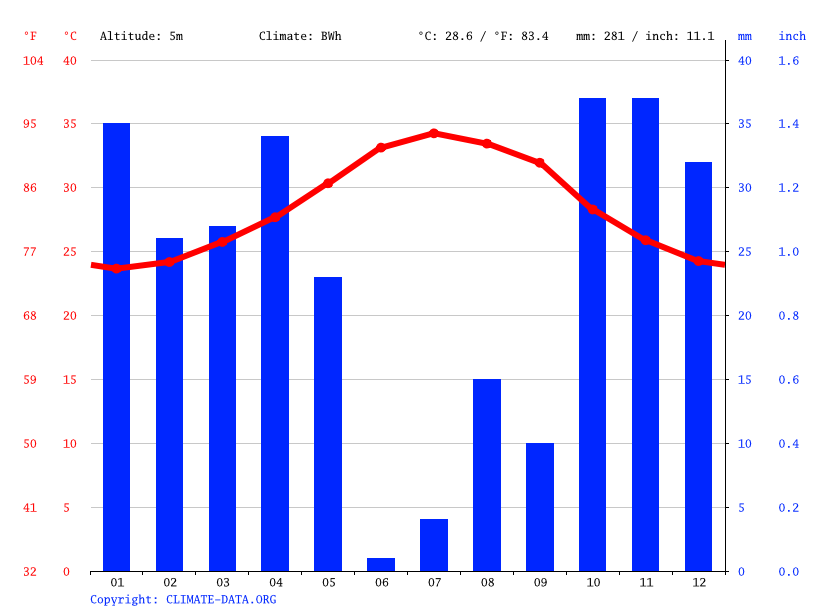
These corridors operate under demanding conditions: ambient temperatures regularly exceeding 40°C, frequent sandstorms, and sustained heavy vehicle traffic. These factors accelerate pavement degradation and increase maintenance requirements.
Prior to implementing CorridorVision AI, road condition assessment relied on manual visual inspections. This approach presented several operational challenges:
| Class | Work Type | Activity | Min | Max | Mean |
|---|---|---|---|---|---|
| Routine | Routine maintenance | Unsealed 2L Highway | 277 | 1,740 | 989 |
| Bituminous 2L Highway | 656 | 5,580 | 2,199 | ||
| Periodic | Grading | Light Grading | 51 | 205 | 110 |
| Heavy Grading | 323 | 876 | 522 | ||
| Gravel resurfacing | Regravelling | 1,997 | 65,038 | 15,326 | |
| Bituminous pavement | Fog Seal | 2,805 | 15,783 | 8,946 | |
| Unsealed | Preventive Treatment | 2,009 | 6,965 | 4,266 | |
| Surface treatment | Slurry / Cape Seal | 4,452 | 27,520 | 9,780 | |
| Single Surface Treatment | 5,295 | 38,607 | 18,937 | ||
| Double Surface Treatment | 10,684 | 45,277 | 27,039 | ||
| Asphalt resurfacing | Overlay < 40 mm | 12,878 | 82,320 | 38,095 | |
| Overlay 40–59 mm | 21,021 | 126,131 | 68,713 | ||
This reactive approach resulted in a data gap: operational activity was documented, but structured, actionable condition data was not systematically captured.
To address these challenges, Djibouti Ports Corridor Road SA (DPCR) developed CorridorVision AI, an automated road condition monitoring system. The solution prioritizes reliability and cost-effectiveness over specialized equipment.
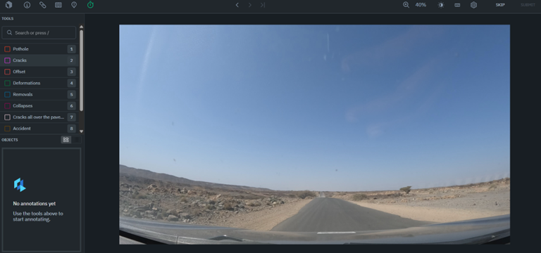
The vehicles are equipped with high-performance 4K/UHD imaging systems, featuring professional-grade action and dash cameras selected for their superior clarity. These devices integrate advanced image stabilization to eliminate motion blur and are specifically engineered for thermal durability, ensuring seamless operation and reliability even in extreme high-temperature environments.
The collected video footage is processed and segmented into individual frames. These images are then uploaded to Labelbox, a data annotation platform where trained annotators classify and label pavement defects—including potholes, cracking patterns, and rutting. This human-supervised labeling process creates high-quality training datasets essential for model accuracy.
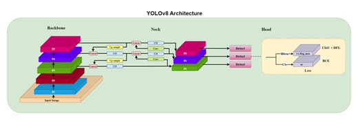
The annotated datasets are used to train a YOLOv8 (You Only Look Once, version 8) object detection model. YOLOv8 is a real-time detection algorithm capable of identifying and localizing multiple defect types within a single frame. The model is iteratively refined as new annotated data becomes available, improving detection accuracy over time.
The trained model is deployed on RapidCanvas, an AI platform that hosts the CorridorVision AI application. The platform processes new video data, automatically detects and classifies road defects, and associates each detection with GPS coordinates for spatial mapping and maintenance planning.
Following the initial data processing, the CorridorVision AI project has already covered over 844 km, successfully identifying 2,174 detections across 4 selected defect types. Despite demanding operational conditions, with a mean altitude of 399 m and GoPro internal temperatures peaking at 79.11°C, the systems maintained full functionality, proving the resilience and reliability of our high-resolution capture setup in extreme environments.
CorridorVision AI is currently in deployment and calibration. As the system matures, DPCR anticipates the following operational improvements:
CorridorVision AI demonstrates that effective infrastructure monitoring can be achieved using commercially available hardware combined with machine learning. By replacing manual inspection with automated detection and classification, DPCR is building the foundation for a data-driven approach to road asset management.
As the system accumulates operational data and the detection model improves through continued training, this approach may serve as a reference for similar infrastructure challenges in the region.